

Winter 1916-17; The severe Winter of the Great War
- Sryan Bruen

- Feb 20, 2019
- 13 min read
Let's talk about the severe Winter of the Great War, Winter 1916-17.
If you love cold or snow, this Winter was nearly about as good as it gets for you as each month of the season from December onwards featured significant snowfalls or cold at some point. The CET for the season was 1.5c making it only the coldest since 1895 at that point in time but to show how severe this is, the coldest Winter in the last 30 years was 2009-10 with a CET of 2.4c so 1916-17 was almost 1 whole degree colder.
December 1916 had a CET of 1.9c which resulted in it being the coldest December since 1892 (although there have been modern Decembers which have beaten this including December 2010 at -0.7c and December 1981 at 0.3c). The cold conditions started to become afoot on the 9th as an area of low pressure pushed southeastwards over the UK & Ireland forcing winds to turn into the northeast eventually. This low led to significant accumulations of snowfall in various regions as it passed over both countries including an observation of snow being over a foot deep at Markree Castle, Co. Sligo on the 9th.
This low essentially got stuck in around the same position for much of the week but tended to weaken and fill with wind speeds dropping day by day only further helping frost to form over time. Newcastle, Co. Wicklow had 34mm of rain and snow on the 12th.
There was also several instances of dense fog and thunderstorms within this unstable cold air mass. Clongowes Wood College, Co. Kildare and Kilkenny got down to -7.2c on the 15th/17th & 16th respectively. Cahir, Co. Tipperary got down to -7.8c on the 16th and again on the 17th.

The low finally disorganised by the 17th/18th but further troughs developed in the cold northeasterly flow causing more outbreaks of snow showers. Glasgow had a snow depth of 18cm on the morning of the 18th.

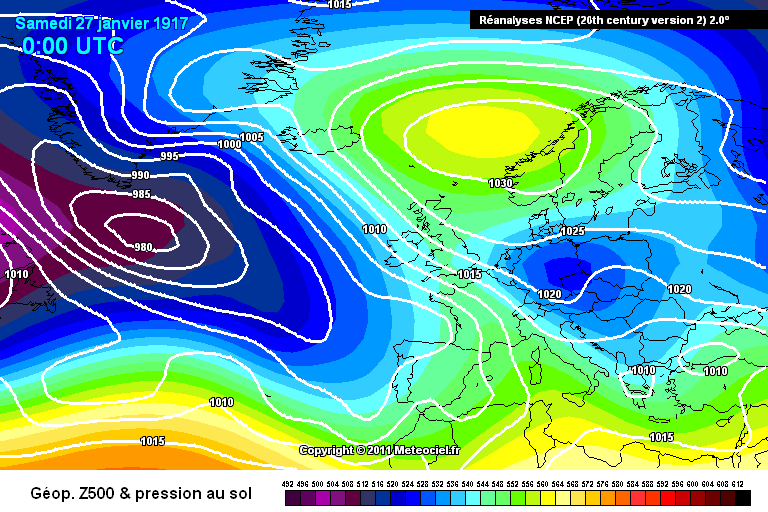
An Atlantic depression arrived on the coast of Kerry early on the morning of the 20th as well as a small secondary on its southern side which reached the western end of the English Channel 24 hours later produced the most disturbed conditions of December 1916. The primary system travelled up the western coasts and as it passed the Hebrides, the barometer at Stornoway sank to 970mb, the lowest pressure record of December 1916 for the UK & Ireland. The secondary swung round across southern England and in the course of the same day dispersed off the east coast. On the 23rd when the primary had reached the Faroe Islands, another secondary developed over the south of England. This secondary became very deep as it crossed Denmark and the barometer fell below 970mb at Copenhagen. On the 25th, yet another secondary formed over Kent and dispersed over Heligoland Bight. On the 20th, the wind reached gale force from south at Holyhead and from south-east at Durness. Next day there was a strong southerly gale at Lerwick, Dungeness and Yarmouth and south-westerly whole gale at Dover. On the 22nd, Blacksod felt a southerly gale and on the 23rd, there was a southerly gale at Dover, a north-west gale at Spurn Head and a southerly whole gale at Dungeness. The last mentioned station reported another southerly gale on the 25th. The Isles of Scilly recorded a maximum gust of 108 km/h on the 23rd.
West Linton got down to -11.7c on the 20th. That same day, there was a rainstorm over southern portions of the UK south of the Thames.
Snow depths on the morning of the 20th were 18cm at Cardiff and 23cm at Glasgow.

These more disturbed conditions ushered in a mild spell of weather to conclude December 1916 after the 27th. The 27th recorded severe frost for several places including -7.7c at Phoenix Park, Co. Dublin. The milder temperatures were the result of the wind veering southwesterly. This was the mildest period of the entire month with a maximum of 15.0c at Rhyl and Shaftesbury on the 28th.

You'd be fooled into thinking that was the end of the Winter as that was only the beginning. The Winter was to get more and more severe as it went on, even as late as April. January 1917 had a CET of 1.6c, the joint coldest (with 1897, exactly 20 years before) since 1895 which had a CET of 0.2c. A complete contrast to the preceding January, January 1916, which had been the warmest January on record with a CET of 7.5c and still is to this day the mildest January in the entire CET record back to 1659.
January 1917 began where December 1916 left off with mild temperatures and a flat westerly to southwesterly flow. There was reports of gales at Malin Head and in parts of Scotland on the 1st. A depression on the 3rd/4th sank southeastwards forcing winds to veer northwesterly and northerly. There was bouts of heavy rain over Scotland rather than snow however with as much as 44mm at Cruachan, Argyll. Flat westerly winds dominated for a few more days with the Euro high attempting to retrogress westwards into the Mid-Atlantic and up to Greenland.
The 7th brought down a northerly gale to most places as a result of a depression marked east. Force 9 or 10 gusts occurred at many stations. The arrival of another depression on the 11th caused the gale to continue until the 13th on various parts of the coast. This unsettled period resulted in a mix of rain or snow to all districts but the quantity of either precipitation type was not large away from some northern and western localities of the UK.


As the low dived south on the 14th, the winds turned easterly and a Scandi High developed by the 20th. Despite the easterly winds, this period tended to be anticyclonic. Nevertheless, this helped to cool the land down for an upcoming blizzard event that was set to strike parts of Ireland. Severe frost was a problem through the period too. Clongowes Wood College, Co. Kildare recorded an air minimum of -11.1c on the 16th.


The Scandi High lay to the northeast of the UK on the 25th with low pressure attempting to attack from the southwest of Ireland up against a cold easterly flow of air. Up to this point, January 1917 wasn't a very snowy month at all with anomalies below average actually for a good portion of both countries. That was soon about to change for Ireland (not much for the UK though). The gradient on the easterly to southeasterly winds increased dramatically to steep levels on the 25th. Valentia Observatory observed a gust of 112 km/h.
You wouldn't have guessed what accompanied the windchill and easterly gales? That's right, large quantities of rain, sleet and snow but most especially snow. The south of Ireland was blanketed in the white stuff. Ballinacurra in Cork recorded 52mm on the 24th and 19mm on the 25th. At Seskin, the total amount of snow on the 25th and 26th yielded, when melted, 47mm of water (25mm on the 25th, 22mm on the 26th and 10mm on the 27th). 1mm of water is equivalent to 1.2cm of snow which meant there was an accumulation of about 56.4cm of snow at Seskin. Drifts from the snowstorm were nearly 3m deep and the average depth on level ground was at least 30cm.
If conditions weren't severe enough with the fact such a snowstorm happened, the snow laid persistently on the ground until February 18th due to the low temperatures day by day afterwards (which gives you a hint of what February 1917 was going to be like).

Even by the 30th January, the pattern was completely blocked with low pressure systems failing to bring in milder conditions unlike with Storm Emma from 2018 when at the same time, the anticyclone to the north retrogressed to North America. There was further light snow showers too at times but accumulations from these not even close to that of the snowstorm of January 25th to 27th in the south of Ireland. Markree Castle, Co. Sligo recorded an air minimum of -10.0c on 31st January.

February 1917 was the coldest month of the Winter but it was not snowy which is unusual to see. The CET was 0.9c making it the coldest since 1895 and the fifth coldest February of the 20th century (behind 1947, 1986, 1963 and 1956). Why and how February was so cold was due to the persistence of severe frosts brought in by a stubborn area of high pressure over top of the snow cover from the end of January.
The first week of February 1917 was dominated by a northeasterly to northerly flow bringing yet more cold conditions. As a deep area of low pressure approached from out of North America, the blocking collapsed over us bringing some very severe frosts of unusual severity.

The high stayed over top of us for a good week or two and as the air contained in this high was very cold, it stayed cold. It was an unusually persistent ridge of high pressure. Remember that there would have snow cover still there from the end of January. Some minimum temperatures in the UK & Ireland during the period:
-20.0c at Benson on the 6th
-19.4c at Wellington on the 6th
-16.7c at Ross-on-Wye on the 6th
-16.7c at Gwernyfed Pk on the 6th
-16.1c at Braemar on the 6th
-16.8c at West Linton on the 6th
-15.6c at Woburn on the 7th
-15.6c at Buxton on the 7th
-15.0c at Wisley on the 7th
-13.9c at Canterbury on the 3rd
-13.9c at Aldershot on the 7th
-15.0c at Clongowes Wood College on the 6th -13.9c at Markree Castle on the 6th -13.3c at Phoenix Park on the 6th -12.8c at Kilkenny on the 6th -11.1c at Glasnevin on the 6th


The winds veered westerly to southwesterly by the 18th February bringing in milder conditions and this melted the snow that was left from January. There was outbreaks of heavy rain in Ireland, southwestern England and Wales including 33mm at Mount Callan, Co. Clare, 31mm at Valentia Observatory, Co. Kerry and 24mm at Birr Castle, Co. Offaly.

Some rain at times for the rest of February 1917 especially in the north of the UK but generally on the dry side again as was the theme of February with the exception of those severe frosts. This time though it was mild as the high tended to centre over Europe for the first time since the start of January.

March 1917 was another very cold month (and wasn't going to be the last with such a significant deviation below average). The CET for the month was 3.2c and only March 1962 was colder in the 20th century. March 2013 was colder too by comparison with a CET of 2.8c. March 1916 had been a significantly cold month too just a year before with a CET of 3.3c so it was amazing how these back to back very cold Marches happened.
In contrast to February, March was an unsettled month but this resulted in frequent occurrences of snow unlike February too.
A strong high over Russia retrogressed westwards into Scandinavia in early March 1917 whilst a deep low in the Atlantic did a northwest to southeast trajectory down the west of Ireland with the winds attempting to veer easterly. This low resulted in a lot of rain for places for several days with daily rainfalls of more than 25mm over a large portion of Ireland on the 4th.
The easterly won the battle by the end of the first week with heavy outbreaks of snow showers developing. However, this was a very temporary easterly as the winds veered to a southwesterly the very next day with a milder period of weather setting back in up to the 14th then an anticyclone built over the country resulting in frosts and then frequent cold zonality took place through the rest of March with the Azores High displaced but evident. There was times where these northwesterly winds turned into northerlies and northeasterlies though.
The lowest temperature seen during March 1917 was -19.4c at Braemar on the 9th following the bitter but temporary easterly flow whilst Ireland's lowest temperatures were -8.3c at Lisburn, Co. Antrim on the 8th and -6.7c at Birr Castle, Co. Offaly on the 28th.


Now time for April. April 1917 was an exceptional month by any stretch of the imagination. The CET for April 1917 was 5.4c making it the joint 5th coldest April on record back to 1659. Coldest April in the past 35 years in comparison was April 1986 with a CET of 5.8c. This month is remembered infamously for a blizzard that struck Ireland leaving record breaking accumulations and depths in its awakening and the fact it occurred in April makes it ever more fascinating. This month also holds the UK lowest temperature record for April and there was a drought period following the severe cold.
Already plentiful evidence of cold on the 1st April 1917 with an intensely cold northerly flow over the UK and Ireland. To emphasise just how cold this northerly was, parts of the north of the UK had subzero daytime maximum temperatures which in April is extremely unusual. -15.0c was recorded early on 2nd April 1917 at Newton Rigg, Cumbria which is the UK record low for April. At the same time, Eskdalemuir in Dumfries & Galloway recorded -14.4c.

An area of low pressure developed over Ireland on the 2nd April and slowly pushed eastwards. The northeasterly winds increasingly became gusty. There was exceptionally heavy snowfall from this as the low yielded a lot of precipitation and it was snow when it came into the cold weather. There was as much as a snow depth of 1.3m and drifts up to 3m in the south and west of Ireland from this system. East Clare measured a depth of 46cm on level ground. These were likely the heaviest they have seen since February 1892 and probably record breaking. The snowstorms since April 1917 including February 1933, February 1947, December 1962, January 1982 and March 2018 have just not matched the severity of the April 1917 blizzard though of course the different events have had different regions of direct impact so it's not a fair comparison when you look at it that way. Interesting nevertheless to think how Ireland's worst blizzard occurred in the month of April out of all months. I mentioned this nearly over exactly a year ago when I posted briefly about it but I still find it unbelievable!
At Fethard-on-Sea, Co. Wexford, the storm was "phenomenal for this mild coast, probably the greatest for 50 years".
The maximum temperature at Birr Castle on 2nd April 1917 was only 1.1c.

I'll reshare the extract from Symons' Meteorological Magazine on the snowstorm of April 1917 here:
The people in East Clare will long remember Palm Sunday, 1917. A little snow fell on the night of March 31st but it was all melted by noon on April 1st. It began to snow again at 2.45 p.m. on that day and at 5.30 p.m. it was 9 inches deep on all roads about Broadford. Two motor cars came to Broadford early in the afternoon and had to stay there till the morning of the 4th. The mail car left Broadford at 6.40 p.m. for Limerick, and did not get there till the evening of the 2nd. Thus taking 24 hours to do 12 miles. The direct road from Broadford to Killaloe is only 8 miles over the mountain. The first four miles of which, to the village of Kilbane, is nearly level, Kilbane being 200 feet above the sea. A mile further on the road gets to the top of the pass of Slounagalough, 892 feet above the sea. It then falls 700 feet in half-a-mile and the last 2 and a half miles to Killaloe is nearly level. On April 1st, a man named James Vaughan (aged 40) and his nephew, Michael Vaughan (aged 12) who both live at Kilbane drove a trap to Killaloe. On their way home that evening, they were caught in the snowstorm. They left their trap at a farm house at the foot of the eastern side of the pass and started to walk home, leading the horse with them. On the evening of the 2nd, some men went to the top of the pass, looking for sheep that had been lost in the snow and were much surprised to see a horse standing there with a harness on him. In a short time they found the two Vaughans lying dead in the snow. There was very severe frost that night. My thermometer here went down to 16f. Only once before (viz., on February 4th) during the past very severe Winter was it so low. No doubt they were killed by the great cold as there is not a bit of shelter to be found on the "Sap Road" as it is called locally. Very few cars ever go over this road though I have seen a map for motorists on which it was marked as the main road to Killaloe. And it is said that one night, some time ago, a strange motor car did actually drive over the "Sap". The drive no doubt driving by the map.
On Monday, April 2nd, Broadford was quite cut off from the outside world. No mail car came or went. All the roads being quite blocked up with snow drifts several feet deep. The day was very fine however with a bright warm sun. The snow on the level ground where it had not drifted was 12 inches deep. But just about the rain gauge, it was 18 inches deep. That is 6 inches over the rim of the gauge. Never before has the gauge been quite hid by snow during the thirty-two years it has been here.
On Tuesday, April 3rd, it was snowing nearly all day and very cold. A mail car came from Quin railway station at 2 p.m. The road here from there being fairly level ground was not blocked with snow. But the mail car from Broadford to Scariff, which started at 2.30 p.m., ran into a drift two miles from here. The horse fell and the car was smashed and the driver had to return to Broadford. In the evening, one of the motor cars tried to get to Limerick but found the road so blocked with snow that it had to return here.
On Wednesday, April 4th, the Broadford-Limerick road was cleared by the road men. A motor bread van came to Broadford to the great pleasure of everyone.
The greatest previous snowstorm I can remember here was on February 19th 1892. Then it was generally only 5 inches deep. But a severe easterly gale blew the snow off the fields into the cuttings on the roads which were quite blocked up with very deep drifts.
Many old men about here have told me they never saw the snow so deep as it was on the morning of April 2nd.
W.A. Bentley, Lient-Col.
Hurdlestown, Broadford, Co. Clare, 11th April 1917
Further wintry conditions continued into the second week of April but not even close to the severity of the first week.

One final cold shot around the 15th April before the drought took place.

High pressure stubbornly sat over the UK & Ireland or just to the west for the rest of April generally with the exception of some rain at times in the final week over Scotland and the northeast of the UK. Much of Ireland and the west of the UK were completely dry throughout this period and this in fact continued up to the middle of May making it possibly the longest drought in the regions since Spring 1893 although Spring 1938 would later beat this.
The lowest temperature seen in Ireland during April 1917 was -7.2c at Phoenix Park, Co. Dublin on the 1st whilst Lisburn, Co. Antrim recorded -7.8c on the 11th.

This continued into early May too with a very dry May dominated by easterly winds. It was fine and warm for the most part. The warm conditions must have been a huge relief to people from the severe Winter that started back in December although drought conditions were to bring more problems before Summer 1917 was very wet especially August.


For the UK as a whole February 1917 was only the coldest since February 1902, and December 1916 was only the coldest since December 1899, which began a seldom-discussed winter that was actually colder in Scotland than 1916/1917 or 1928/1929.
In many ways the winter of 1916/1917 is very similar to that of 1890/1891 – although 1916/1917 was colder in Scotland and Northern Ireland than that earlier winter and had more snow – in that both saw extremely extended winter cold into the spring, and were followed by terrible Augusts and very wet Octobers. October 1917 was itself an interesting month of exceptionally cold and wet northwesterly winds, quite atypical circulation patterns being involved. The only cases of comparable extended…